
Whether you are looking for a gentle paddle down a chalk stream, a multi-day canoe expedition, or a refreshing open-water swim, the “Garden of England” has plenty to offer. The River Stour and the River Medway are the most famous rivers and offer scenic, tree-lined swims. They rise in the high wooded downs and are often slow-moving in the summer, providing idyllic, peaceful dips surrounded by wildlife. But there are smaller streams and pools too, some of which flow from the chalk downs, as well as several lakes and reservoirs with swimming, boating and plenty of family fun.
River Darent & North West Kent
In the north west of the county, a pretty stream flows from the North Downs. The River Darent is a beautiful, groundwater-fed chalk stream, which makes its water exceptionally clear and vital for local ecology. While it is generally shallow and narrow, there are small pools through Shoreham and Otford (51.3127, 0.1847, follow the Darent Valley Path) perfect for children to splash around in. Or a short walk from Eynsford Station, more pools and a ford run through this popular village (51.3680, 0.2092). Great fun for kids, the Plough Inn is also adjacent for a pint and lunch (DA4 0AE, 01322 862281). Upstream, the lane leads to Lullingstone Castle gardens and lake. Downstream, follow the High Street to Eynsford Castle, which is free to explore.

There are also plenty of man-made lakes in the area, now popular for water activities (ME2 1BA, 51.3531, 0.4350). St Andrews Lake in Halling is a former chalk quarry with turquoise water, a chalky-white floor and a sandy beach – you could almost be in the Caribbean. Verdant cliffs surround deep, clear, cold azure water. An aqua park and paddle boarding are available (01634 926 204). Hadleigh Country Park has a small but perfectly formed man-made supervised swimming lake with spectacular views across the Thames Estuary (SS7 2PP, 51.5503, 0.597, hadleighplungersows.co.uk). Bluewater Lake offers all-year-round supervised swimming in a dramatic high-walled quarry, also with inflatables and zip wires (51.4387, 0.2641, hanglooseadventure.com).
River Medway & South West Kent
The River Medway is Kent’s longest river, rising on the sandstone ridge of the High Weald, and flowing down through the Vale of Kent. Don’t worry, the peaty smell and brownish hues are due to the pine cones and leaves of Ashdown Forest. In its upper reaches, in remote fields north of Poundsbridge, there is a bridge with some deep pools under red earth banks, popular for jumps with local kids. Check for “No Swimming” signs first (TN11 8AJ, 51.1541, 0.1968). A few miles downstream it flows past beautiful Penshurst Place and gardens. Ensfield Bridge is an open, sunny stretch of river with a waterside footpath (51.1857, 0.2133). The banks of the river slope steeply into rich, clean, and weed-free water.

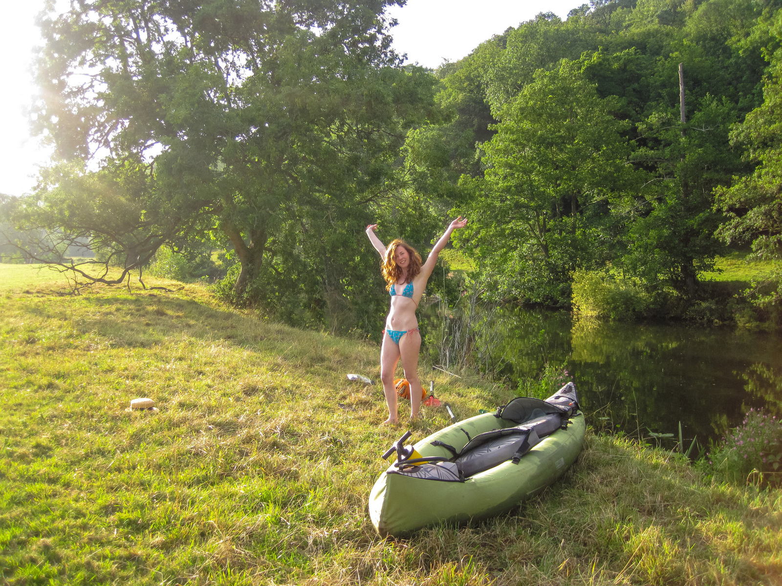
Follow the young Medway as the river winds towards Tonbridge on the Eden Valley Walk (the Eden is a quiet tributary, which is also worth exploring). As the river path approaches the town it doubles up as Cycle Route 12, which is a lovely way to travel alongside the water. Or how about launching your paddle board? The Medway Canoe Trail starts in Tonbridge itself, a designated 29km route to Allington Lock (just north of Maidstone). It features canoe passes around the locks, plenty of launch spots, and riverside campsites.
The Medway east of Tonbridge is quiet, meandering and bucolic, perfect Wind in the Willows countryside. There are open meadows and mainly easy banks into deep water, but be careful to avoid the bigger boats and locks. From Golden Green (The Bell Inn, TN11 0BD) Kelchers Lane leads to East Lock, a great point from which to explore and find wild swim spots (51.2009, 0.3537). Further downstream leads to Oak Weir lock,and you’ll also find wild gravel lakes on the footpaths too, nice for a picnic. Yalding Lees is further on still. Kids play at the weir, despite the signs and dangers, but local groups swim from the ancient common land, downstream of the medieval bridge. Council parking is available by the bridge (51.2227, 0.4214, ME18 6HG).
River Great Stour & East Kent
Rising in the Kent Downs, the Great Stour river is one of Kent’s most beloved rivers for both wild swimming and paddling, cutting a scenic route through the eastern part of the county above Ashford. Gorgeous in the summer sun, there’s paddling to be had upstream or downstream of the train station at Wye (follow the Stour Valley Way a mile or so in either direction, e.g. up to 51.1771, 0.9289 or down to Olantigh at 51.2017, 0.947). There is a deeper swim at Chartham. Quiet riverside paths make for gentle walks or cycling, and picnic spots beneath the trees are perfect for enjoying the quiet pace of river life. Park at Chartham village hall and follow the path 300m down along the stream to find the small weir, deep pool beneath and rope swing (also on cycle path 18, 51.2562, 1.0215).

Beyond Canterbury, the Great Stour flows through England’s smallest town. At first it is open and sunny, with a bench and little beach, then becomes wooded and secretive with glades (51.3001,1.1513) leading to a wild gravel lake. It makes for ideal canoeing, and if you don’t have a boat you can hire from CanoeWild (07947835688, canoewild.co.uk). The route is called the Grove Ferry Canoe Trail and a handy map can be found online. The river winds through the Westbere Marshes and the Stodmarsh National Nature Reserve, teeming with wildlife. If you are quiet, you might spot kingfishers, water voles, or even the wild beavers that have been reintroduced to the area. Heading east, it arrives at Grove Ferry Inn and the riverside picnic site, a superb place for watery fun (CT3 4BP, 51.3233, 1.2094). There are also large, wild gravel lakes alongside the river, with south-facing bays, accessible more quickly from Westbere village (cross the railway and bear right, 51.3047, 1.1479).

Don’t forget the little sister of the Stour, the Little Stour. At the picturesque village of Wickhambreaux there is a pretty stream and shallow weir pool. Follow the path from the 16th-century Rose Inn to find a small weir pool (CT3 1RQ, 51.286, 1.1961). Or follow the riverside path down the Newnham Valley to Blue Bridge.
River Rother & Southern Kent
The River Rother acts as the scenic, winding border between Kent and East Sussex for much of its length before flowing out to the sea at Rye Bay. It is a fantastic, slow-moving river steeped in history and surrounded by peaceful marshlands and willow-lined banks. It’s arguably one of the best rivers for paddling thanks to its gentle flow and lack of locks on the upper stretches. Newenden to Bodiam Castle is a classic route between Newenden (Kent’s smallest village) and the spectacular 14th-century Bodiam Castle. You can launch your own craft or hire canoes, kayaks, and paddleboards from the Bodiam Boating Station right at Newenden Bridge. Paddling up to the moated ruins of the castle is a truly magical experience. For a longer, more open expedition, you can navigate the river as it winds through the Rother Levels down towards Scots Float sluice (just north of the historic town of Rye).

For more history, walk or canoe the Royal Military Canal at Bonnington. It’s a Napoleonic Wars defensive canal, and the pretty Saxon church of St Rumwold’s is one of the oldest on the Marshes (51.0707, 0.9435).
Bewl Water and other reservoirs
Bewl Water (on the Sussex Border) is the largest reservoir in the South East, surrounded by 800 acres of woodland and parkland. It features miles of wild, rugged shoreline to explore and is a major hub for water sports, with pedalos, canoes, and paddleboards available to explore its shorelines and wild bays. Officially swimming is not allowed, but there are officially lifeguarded open-water swimming sessions (typically on Saturday mornings between April and October). You must pre-book, wear a bright swim cap, and usually wear a wetsuit. There is footpath access around the entire perimeter and a 20km mountain bike route. From the main visitor centre head west along the north shore to Bramble Bay. My favourite access point is from Three Leg Cross (51.0613, 0.3948) – from the Bull Inn (TN5 7HH) head down Boarders Lane. You can also camp out near the shores at Cedar Gables campsite in Flimwell (TN5 7QA, 01892 890566). The path behind leads down to a sunset-facing wooded cove (51.0675, 0.4097).
There’s a growing campaign for more access to reservoirs for swimming. They are a national asset and were only transferred into private hands on condition that access would remain for all reasonable leisure pursuits. They are also cleaner than rivers, and tend to have safer, easier access waters (beachy entry etc). However, access at Bewl and other Southern Waters lakes is very limited, so unless you are a rogue dipper, you will need to simply look at the water longingly.

Other reservoirs include Bough Beech Lake, a hidden, wooded reservoir, previously a nature reserve, with some beach areas. Park and walk south west from the old oast house (TN14 6LD, 51.2245, 0.1402). Weir Wood Reservoir offers lifeguarded swim sessions three times a week and night swims during the summer. Wetsuit-only venue. Swim from the sailing club (RH18 5HT) on the south side. Book on 01342 621271 (51.0960, 0.0062).
Other lakes include Leybourne Lakes Country Park in Aylesford. Set within a nature reserve, the 30-acre “Ocean Lake” is a haven for water sports and bookable open-water swimming. Kayaking, windsurfing, and paddleboarding are also available.
Water quality
As with many lowland rivers that flow through towns and surrounded by agricultural land, water quality can fluctuate, especially immediately after very heavy rainfall which increases agricultural runoff and can open sewer outflows. Always check local Environment Agency advice or speak to the boating station before taking a deep dive. The Rivers Trust Sewage Map has an excellent online map for checking sewer overflows in real time, and for checking historic water quality.
About the book
Wild Guide London & South East England publishes 1st May, £18.99 from wildthingspublishing.com. Daniel is also author of Wild Swimming Britain.
