‘Wild Swimming: 150 hidden dips’ provides grid references, postcodes and direcions for 150 freshwater wild swimming spots in Britain. An additional 80 swims are also included with grid references only. (NB You can see if your favourite area is covered on the coverage map).
There are three methods to find each location.
1) Directions: Follow the step-by-step written directions that come with each of the wild swims. These will get you to all 230 places but you might like the added help of using a map as well, or the convenienece of using a postcode with SatNav too (read on). Click here for more on using the directions.
2) Postcodes: Every swim has also been located with both a postcode (useful for those relying on SatNav devices in cars). The postcode
only pinpoints the swim to within about 1km (in rural areas), so a distance
is sometimes given next to it e.g. ‘500m N’ means ‘look 500m north of
the postcode’. POstcodes are also helpful in Google Maps (which don’t accept grid references).
3) Maps and Grid References: OS eight-digit grid references (two letters, six numbers, no spaces) are the most accurate reference and will guide you to within 100m of the wild swim place. You can print out a 1:25,000 or 1:50,000 map for free on the web.
Here’s how:
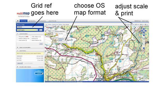
Bing maps https://www.bing.com/maps provides free 1:50,000 OS mapping (the purple Landranger maps) essential for navigation in the countryside. Streetmap also provides this format. Type in the Grid Reference provided in the book (e.g. SN896093: two letters, six numbers, no spaces). A map appears and you can chose between the TeleAtlas format or the Ordance Survey (OS) format (in the top left of the map click the Map button and the arrow key next to it). You can also zoom in or out (the Ordnace Survey option is only available at some zoom levels). Then print your map and take it with you. Voila!
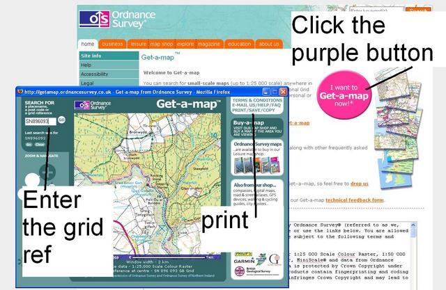
You can only find the hardcore 1:25,000 OS walking maps (the orange Explorer maps, even better for finding remote places) at the Ordnance Survey Get-A-Map website. Click on the purple ‘Get-a-Map’ button and type in your grid reference with no spaces. You can then print out the section by clicking ‘save / print / copy’.
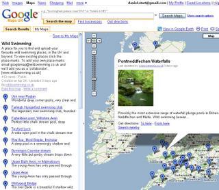
We’ve loaded up a range of wild swims into the nice maps from Google. You can find them here. We’ve added a litle selection from the Wild Swimming book but it’s mainly a place for new outdoor swims. Please consider becoming a ‘collaborator’ (!) on Google maps and uploading your own favourite places with photos so we can help grow this collection. Alternatively email us at swims AT wildswimming.co.uk and we’ll upload them for you.


